
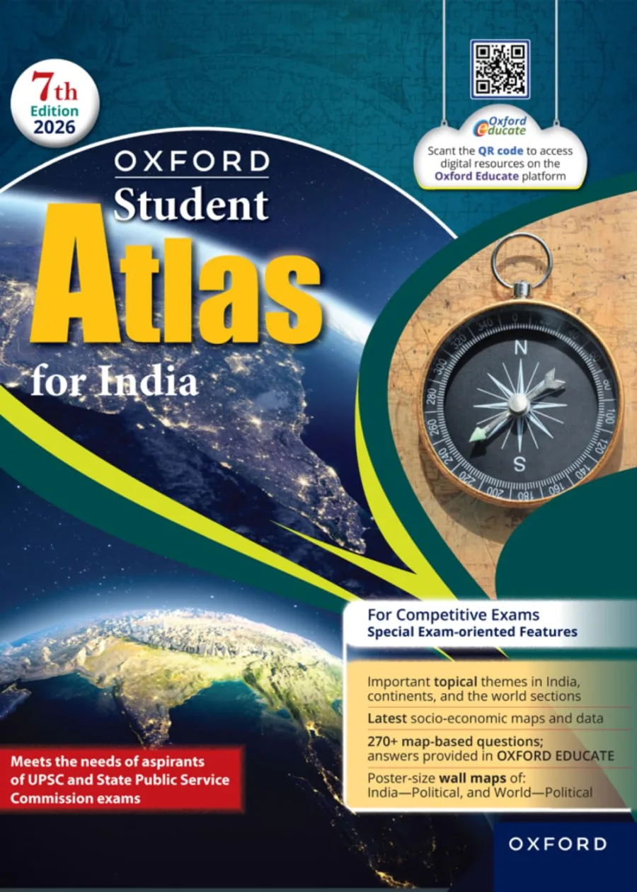
Oxford Student Atlas for India | For UPSC and Other Competitive Exams | 7th Edition
Paperback
• 160 Pages
• ₹ 425.00
• English
• 9789373745138
No ratings yet
| Publisher | Oxford University Press |
|---|---|
| ISBN13 | 9789373745138 |
| ASIN/SKU | 9373745131 |
| Book Format | Paperback |
| Language | English |
| Pages | 160 |
| List Price | ₹ 425.00 |
| Publishing Date | 10/12/2025 |
| Dimensions | 27.6 x 21.6 x 2.8 cm |
| Weight | 410 g |
| Book Code | BD00056064 |
Buy this Book
Amazon Stores
Ebook Stores
Other Stores
Discover Oxford Student Atlas for India | For UPSC and Other Competitive Exams | 7th Edition by Oxford University Press. This book is published by Oxford University Press in Paperback format, ISBN 9789373745138, ASIN 9373745131, under Exam Preparation, School Atlases, UPSC Civil Services.
Book Description
Explore India and the World:
The Definitive Oxford Student Atlas (7th Edition 2026) Navigate the complexities of physical, political, and thematic geography with the all-new, thoroughly updated Oxford Student Atlas for India, 7th Edition.
This essential educational tool uses cutting-edge mapping technology to deliver accurate, easy-to-read maps that cater to the syllabi requirements of various education boards and competitive examinations in India.
Why this Atlas is a Must-Have:
• Up-to-Date Information: Reflects recent administrative changes and incorporates the latest socio-economic data for reliable study.
• Visual Learning: High-resolution, vibrant maps with clear color contrasts make complex geographical concepts easy to understand and remember.
• Versatile Use: An ideal companion for school projects, college-level courses, and rigorous preparation for competitive exams like the UPSC.
• Enhanced Resources: Comes with supplementary features designed to aid in better retention and application of geographical knowledge.
The Definitive Oxford Student Atlas (7th Edition 2026) Navigate the complexities of physical, political, and thematic geography with the all-new, thoroughly updated Oxford Student Atlas for India, 7th Edition.
This essential educational tool uses cutting-edge mapping technology to deliver accurate, easy-to-read maps that cater to the syllabi requirements of various education boards and competitive examinations in India.
Why this Atlas is a Must-Have:
• Up-to-Date Information: Reflects recent administrative changes and incorporates the latest socio-economic data for reliable study.
• Visual Learning: High-resolution, vibrant maps with clear color contrasts make complex geographical concepts easy to understand and remember.
• Versatile Use: An ideal companion for school projects, college-level courses, and rigorous preparation for competitive exams like the UPSC.
• Enhanced Resources: Comes with supplementary features designed to aid in better retention and application of geographical knowledge.
Author Biography
Oxford University Press advances knowledge and learning of all kinds, from a child reading their first words to a researcher expanding the frontiers of their field. Our work is constantly evolving, and the possibilities are endless. We strive to help more and more people around the world achieve their potential. Oxford University Press is a department of the University of Oxford. It is our mission to further the University's objective of excellence in research, scholarship, and education by publishing worldwide.
Editorial Reviews
Editorial Reviews will be added soon…
Book Summary
Oxford Student Atlas for India, 7th Edition, published by Oxford University Press, is a comprehensive map-based reference book designed to help students understand the geography of India through clear, detailed, and systematically arranged maps. It is particularly useful for learners preparing for school examinations, UPSC, and other competitive examinations in which geographical awareness and map-based understanding are important. Rather than presenting geography mainly through long explanations, the atlas allows students to learn by observing locations, boundaries, physical features, resources, transportation networks, population patterns, agriculture, industries, and other geographical information visually.
The central strength of an atlas is that it transforms geographical information into something that can be seen. Reading that a river originates in one region, flows through several states, and eventually reaches the sea gives a basic understanding, but locating those places on a map creates a much stronger mental picture. Oxford Student Atlas for India uses this principle throughout the book. By repeatedly studying maps, students can gradually develop a sense of where different places are located and how India's physical and human features are connected.
The atlas begins with the fundamental geographical framework needed to understand maps. Students learn about India's location, extent, surrounding countries, neighbouring seas, major regions, and broad physical divisions. This basic orientation is important because more detailed geographical information becomes easier to understand once the learner has a clear mental picture of India's overall shape and position.
Physical geography forms a major part of the atlas. Maps illustrate India's mountains, plateaus, plains, deserts, coastal areas, islands, rivers, and other important landforms. The Himalayas, Northern Plains, Peninsular Plateau, Indian Desert, coastal plains, and island groups can be studied visually rather than simply memorized as names. Such maps help students understand why different regions have different climates, soils, vegetation, agricultural patterns, and settlement characteristics.
Rivers and drainage systems receive particular importance. Indian geography questions frequently require students to know the origins, courses, tributaries, and destinations of major rivers. A map makes these relationships much easier to understand. Instead of remembering rivers as isolated facts, students can follow their paths and see how they relate to mountains, plains, cities, states, and agricultural regions. The Ganga, Brahmaputra, Indus, Godavari, Krishna, Narmada, Tapi, Mahanadi, and other river systems can therefore be studied as parts of larger drainage patterns.
Climate maps provide another important area of study. India has considerable climatic diversity, and maps can help students understand the distribution of rainfall, temperature, monsoon patterns, and other climatic features. By comparing these maps with physical geography, learners can begin to understand why certain regions receive heavy rainfall while others remain comparatively dry. This geographical relationship is useful when studying agriculture, vegetation, population, and water resources.
Soil and natural vegetation are also easier to understand through maps. India contains several major soil types, including alluvial, black, red, laterite, desert, and mountain soils. Their distribution is connected with physical conditions and agricultural activity. A map allows students to see where particular soil types occur and then connect those areas with crops and economic activities. This makes memorization more meaningful because several facts can be understood together.
Agriculture is another important component of the atlas. Maps can show the distribution of major crops such as rice, wheat, cotton, sugarcane, tea, coffee, jute, and other agricultural products. Students preparing for competitive examinations can use these maps to connect crops with states, climatic conditions, soils, irrigation, and agricultural regions. This is especially useful because geography questions often ask where particular crops are produced or which regions are associated with specific agricultural activities.
The atlas also provides maps related to minerals and industries. India has a diverse distribution of coal, iron ore, petroleum, natural gas, bauxite, manganese, and other mineral resources. Industrial development is closely connected with the availability of raw materials, energy, transportation, labour, and markets. By studying resource and industrial maps together, students can begin to understand why certain industrial regions developed in particular parts of the country.
Transportation maps are similarly useful. Railways, roads, ports, airports, and important communication routes connect different parts of India and influence economic development. For a competitive-exam student, memorizing the names of important ports or railway routes can be difficult without spatial context. Maps provide that context by showing where these places are located and how they relate to major cities and economic regions.
Population and settlement maps add another dimension to the study of Indian geography. India has considerable variation in population density, urbanization, and settlement patterns. Some regions are densely populated because of fertile land, water availability, economic opportunities, or historical development, while others have lower population densities because of difficult terrain, arid conditions, forests, or other geographical factors. Studying these patterns visually helps students understand the reasons behind regional differences.
Political maps are essential for students preparing for examinations because they provide information about states, union territories, capitals, and boundaries. Political boundaries can change over time, so students should use the latest available edition when preparing for an examination. Learning locations from maps is more effective than simply memorizing lists because students can develop a spatial understanding of India's political divisions.
The atlas is particularly valuable for UPSC preparation. The Civil Services Examination requires candidates to have a strong understanding of geography, and map-based knowledge can support both objective and descriptive preparation. In the preliminary examination, candidates may encounter questions involving rivers, mountains, national parks, states, resources, agricultural regions, seas, islands, or locations in the news. In the mains examination, geographical understanding can strengthen answers by allowing candidates to describe spatial patterns and relationships more accurately.
For other competitive examinations, the atlas can also serve as a useful revision tool. SSC, Railway, defence, banking, teaching, and state-level examinations may include questions involving Indian geography. A student can use the atlas to revise important locations quickly, especially before an examination. Maps can also help identify weak areas that need additional study.
One of the most important lessons an atlas teaches is that geography is about relationships rather than isolated facts. Mountains influence rivers; rivers influence agriculture; climate affects crops; resources influence industries; transportation connects economic centres; and physical conditions influence population distribution. When students study these relationships visually, geography becomes easier to understand and remember.
The atlas can also be used alongside standard geography textbooks. A textbook may explain why the monsoon occurs, while the atlas can show its spatial distribution. A textbook may describe the Himalayan river systems, while the atlas allows students to trace them. This combination of explanation and visual reference creates a more complete learning experience.
Overall, Oxford Student Atlas for India, 7th Edition, is a practical and visually oriented resource for understanding India's geography. Its maps help students study physical features, rivers, climate, soils, vegetation, agriculture, minerals, industries, transportation, population, political divisions, and many other geographical subjects. Its greatest advantage is that it turns information that might otherwise require extensive memorization into something students can observe and connect spatially.
For UPSC and other competitive-exam aspirants, the atlas is best used as a regular reference rather than a book to read from beginning to end like a conventional textbook. Repeated map practice can gradually build geographical memory and improve the ability to locate places quickly.
The central strength of an atlas is that it transforms geographical information into something that can be seen. Reading that a river originates in one region, flows through several states, and eventually reaches the sea gives a basic understanding, but locating those places on a map creates a much stronger mental picture. Oxford Student Atlas for India uses this principle throughout the book. By repeatedly studying maps, students can gradually develop a sense of where different places are located and how India's physical and human features are connected.
The atlas begins with the fundamental geographical framework needed to understand maps. Students learn about India's location, extent, surrounding countries, neighbouring seas, major regions, and broad physical divisions. This basic orientation is important because more detailed geographical information becomes easier to understand once the learner has a clear mental picture of India's overall shape and position.
Physical geography forms a major part of the atlas. Maps illustrate India's mountains, plateaus, plains, deserts, coastal areas, islands, rivers, and other important landforms. The Himalayas, Northern Plains, Peninsular Plateau, Indian Desert, coastal plains, and island groups can be studied visually rather than simply memorized as names. Such maps help students understand why different regions have different climates, soils, vegetation, agricultural patterns, and settlement characteristics.
Rivers and drainage systems receive particular importance. Indian geography questions frequently require students to know the origins, courses, tributaries, and destinations of major rivers. A map makes these relationships much easier to understand. Instead of remembering rivers as isolated facts, students can follow their paths and see how they relate to mountains, plains, cities, states, and agricultural regions. The Ganga, Brahmaputra, Indus, Godavari, Krishna, Narmada, Tapi, Mahanadi, and other river systems can therefore be studied as parts of larger drainage patterns.
Climate maps provide another important area of study. India has considerable climatic diversity, and maps can help students understand the distribution of rainfall, temperature, monsoon patterns, and other climatic features. By comparing these maps with physical geography, learners can begin to understand why certain regions receive heavy rainfall while others remain comparatively dry. This geographical relationship is useful when studying agriculture, vegetation, population, and water resources.
Soil and natural vegetation are also easier to understand through maps. India contains several major soil types, including alluvial, black, red, laterite, desert, and mountain soils. Their distribution is connected with physical conditions and agricultural activity. A map allows students to see where particular soil types occur and then connect those areas with crops and economic activities. This makes memorization more meaningful because several facts can be understood together.
Agriculture is another important component of the atlas. Maps can show the distribution of major crops such as rice, wheat, cotton, sugarcane, tea, coffee, jute, and other agricultural products. Students preparing for competitive examinations can use these maps to connect crops with states, climatic conditions, soils, irrigation, and agricultural regions. This is especially useful because geography questions often ask where particular crops are produced or which regions are associated with specific agricultural activities.
The atlas also provides maps related to minerals and industries. India has a diverse distribution of coal, iron ore, petroleum, natural gas, bauxite, manganese, and other mineral resources. Industrial development is closely connected with the availability of raw materials, energy, transportation, labour, and markets. By studying resource and industrial maps together, students can begin to understand why certain industrial regions developed in particular parts of the country.
Transportation maps are similarly useful. Railways, roads, ports, airports, and important communication routes connect different parts of India and influence economic development. For a competitive-exam student, memorizing the names of important ports or railway routes can be difficult without spatial context. Maps provide that context by showing where these places are located and how they relate to major cities and economic regions.
Population and settlement maps add another dimension to the study of Indian geography. India has considerable variation in population density, urbanization, and settlement patterns. Some regions are densely populated because of fertile land, water availability, economic opportunities, or historical development, while others have lower population densities because of difficult terrain, arid conditions, forests, or other geographical factors. Studying these patterns visually helps students understand the reasons behind regional differences.
Political maps are essential for students preparing for examinations because they provide information about states, union territories, capitals, and boundaries. Political boundaries can change over time, so students should use the latest available edition when preparing for an examination. Learning locations from maps is more effective than simply memorizing lists because students can develop a spatial understanding of India's political divisions.
The atlas is particularly valuable for UPSC preparation. The Civil Services Examination requires candidates to have a strong understanding of geography, and map-based knowledge can support both objective and descriptive preparation. In the preliminary examination, candidates may encounter questions involving rivers, mountains, national parks, states, resources, agricultural regions, seas, islands, or locations in the news. In the mains examination, geographical understanding can strengthen answers by allowing candidates to describe spatial patterns and relationships more accurately.
For other competitive examinations, the atlas can also serve as a useful revision tool. SSC, Railway, defence, banking, teaching, and state-level examinations may include questions involving Indian geography. A student can use the atlas to revise important locations quickly, especially before an examination. Maps can also help identify weak areas that need additional study.
One of the most important lessons an atlas teaches is that geography is about relationships rather than isolated facts. Mountains influence rivers; rivers influence agriculture; climate affects crops; resources influence industries; transportation connects economic centres; and physical conditions influence population distribution. When students study these relationships visually, geography becomes easier to understand and remember.
The atlas can also be used alongside standard geography textbooks. A textbook may explain why the monsoon occurs, while the atlas can show its spatial distribution. A textbook may describe the Himalayan river systems, while the atlas allows students to trace them. This combination of explanation and visual reference creates a more complete learning experience.
Overall, Oxford Student Atlas for India, 7th Edition, is a practical and visually oriented resource for understanding India's geography. Its maps help students study physical features, rivers, climate, soils, vegetation, agriculture, minerals, industries, transportation, population, political divisions, and many other geographical subjects. Its greatest advantage is that it turns information that might otherwise require extensive memorization into something students can observe and connect spatially.
For UPSC and other competitive-exam aspirants, the atlas is best used as a regular reference rather than a book to read from beginning to end like a conventional textbook. Repeated map practice can gradually build geographical memory and improve the ability to locate places quickly.
Sample Chapters
Sample Chapters will be added soon…
Reader Reviews
No reviews yet.
Oxford Student Atlas for India | For UPSC and Other Competitive Exams | 7th Edition
Download Cover Image
Do you want to download the full cover image for Oxford Student Atlas for India | For UPSC and Other Competitive Exams | 7th Edition?